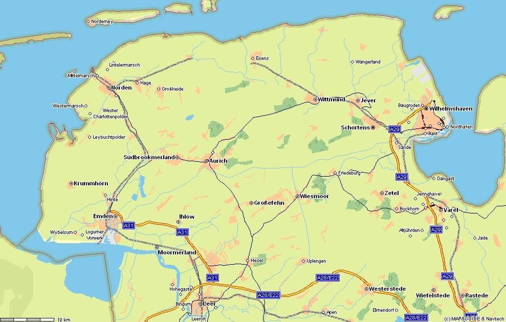
Ok, so the town my school is in is called Esens. It is right in the middle near the coast. Sort of in the middle of nowhere. The towns I live in are too small to make it on any map I find. Stedesdorf is actually the village I live in. It is about halfway between Esens and Wittmund. Click on the map to make it bigger.
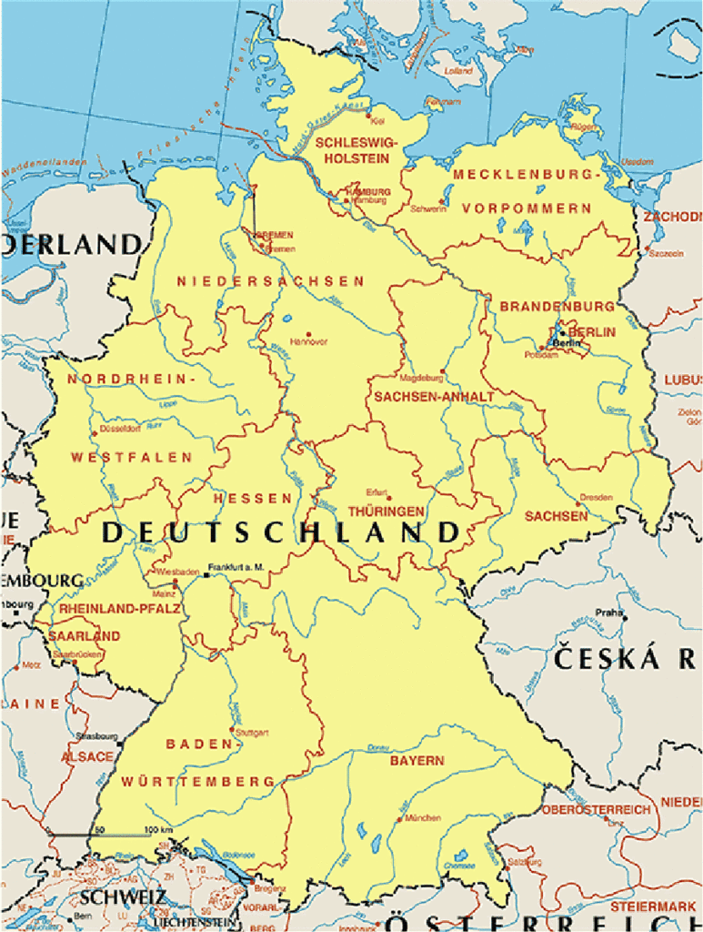 On the map of the whole of Germany, I am going to be on the peninsula right next to the Neatherlands (which is cut off). The area is called Ostfriesland (East Frisia) and is actually one part of the ancient kingdom of Frisia. The "state" that Ostfriesland is located in is called Niedersachen (Lower Saxony). Ostfriesland is very low lying and is plagued by massive flooding (at it's worst in history, it was about to Wittmund). Today there are massive dikes. The islands and coast make East Frisia one of the most popular tourist locations in northern Germany for natives.
My school is called the NIGE, which is short for
Niedersächsisches Internatsgymnasium Esens.
Which is a mouth-full (and I still can not pronounce). I will be staying with 4 different host families. School for me starts on the 24th of August. My host family wants me to bike to school, which I think is cool, because I love to bike. I guess that is all my essential information. Let me know if there is something that I should add.
2 comments:
my mother's father's people came from east frisia back in the 1840's. they moved to texas and then to indiana. a many great grandpa served with the union army and then after the war moved to kansas. in his old age at the turn of the 20th century he went back to east frisia for a visit. He didn't recognize anyone in his hometown. so he went back home to kansas.
things change.
I , also have roots on the neidersachs cultural line. My forebears were von Insel Fohr in the Nordzee gecommen. bobfl
Post a Comment